
- Home
- Live Blog
- Breaking News
- Top Headlines
- Cities
- NE News
- Sentinel Media
- Sports
- Education
- Jobs
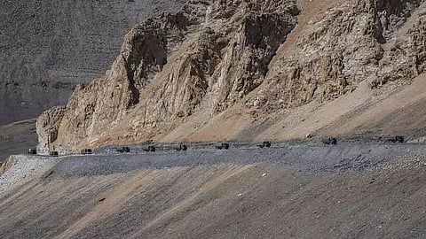
ITANAGAR: China is constructing a new heliport about 20 kilometers east of the Line of Actual Control (LAC) near Arunachal Pradesh's 'Fishtails' region, as per India Today’s report.
This new heliport could significantly increase China's military power in this remote and relatively less developed region. The development would be part of China's more comprehensive plans to increase its military muscle on the disputed border with India, which is sending fresh jitters into New Delhi, India Today reports.
The construction heliport is on the Gongrigabu Qu River in Tibet's Nyingchi Prefecture but in undisputed Chinese territory. This raises more questions about China's military push in that area.
Images provided by open-source satellite companies EOS Data Analytics have shown that no construction existed at the land of the heliport as of 1st December 2023. By end December, land clearing began. This means that construction had already begun.
Images by Maxar of the same region date back to September 16, 2024. In those images, one can see that the constructions have progressed by a margin that is pretty great. Heliport completion is almost close.
Damien Symon, the geospatial intelligence expert who first identified the heliport, said that a new facility will enhance the PLA's capacity to gather intelligence, observe, and conduct reconnaissance.
He noted that the heliport has facilitated circumvention of logistical hurdles in unattainable, wild, and mountainous areas that are not accessible by conventional access routes. Symon further indicated that the heliport has effectively expedited rapid troop deployment in remote regions, improving patrolling efficiency while expanding China's military reach into strategic locations.
Though it falls in the Chinese territory, over which India does not have an issue, it still remains a cause of concern to India due to its strategic angle.
The region is known as the Fishtails because of the shape of the border in this region. It is very sensitive for both countries as they have different views about where the LAC actually lies.
There are two areas which comprise the region: Fishtail 1 at the Dibang Valley and Fishtail 2 that stretches into the Anjaw district of Arunachal Pradesh. India Today says both of these are essential flashpoints over the present border tensions between the two countries.
According to military experts and sources on a surveillance related to the construction, this heliport is vital for China's operations in the region. The runway 600 meters long is designed to enable helicopter takeoff; it comes in handy when supported by limited power because helicopters tend to have a very hard time in places at high altitudes. The place is at an altitude of some 5,000 feet or 1,500 meters and offers major operational advantage.
That relatively low elevation enables the helicopters and other aircraft to carry more payload as they can afford to carry, compared to the high altitudes of the Tibetan plateau.
Military sources have reportedly advised that although the heliport is strictly a military project, it may be used for civil purposes: "moving people into remote areas".
While civilian applications will be used, this heliport will significantly improve the readiness of China to rapidly mobilize troops if necessary. According to one source, it was also mentioned that the facility will boost defense and offense capabilities along with reaction capability and will mobilize forces at a rapid pace in case of any emergency.
Satellite images show at least three finished hangars, and four more under construction. It also consists of a considerable apron space for helicopters to park and run around, as well as other necessary infrastructure such as an air traffic control facility and support buildings. These features indicate the effort China is making to fortify its military logistics in this somewhat inaccessible region.
This work in the construction of the heliport corresponds to China's continuing development of border villages it describes as "Xiaokang" or dual-use. Such dual-use villages are sometimes built in disputed areas and have military and civilian uses.
They form an important part of China's strategy in piecemeal advancing its territorial claims by small steps on the ground in an act of "salami slicing," which means making small advances as a way of changing the status quo without initiating full-scale military conflicts.
China has applied the approach in other disputed regions. For example, in Bhutan, China has constructed whole townships and large road systems in previously uninhabited border regions.
A portion of these regions is traditional lands to the royal family of Bhutan. By establishing the towns and improving their infrastructures, China will be left in a position of administrative control of the disputed region without having to confront others directly.
ALSO WATCH:
